Keynote Speakers (alphabetical order)
 Feng GAO
United States Department of Agriculture, USA
Dr. Feng Gao is a Research Physical Scientist at the USDA-ARS Hydrology and Remote Sensing Laboratory in Beltsville, MD and a member of the Landsat Science Team. Dr. Gao’s research includes crop condition monitoring through fusing high temporal and high spatial remote sensing data, land cover and land use change detection using dense time-series data integrated from multiple sensors, surface reflectance anisotropy (bi-directional reflectance distribution function) modeling and correction, and surface biophysical parameters retrieval from remote sensing data.
Dr. Gao is internationally acclaimed for his development of multiple high-impact remote sensing algorithms and tools that have advanced research related to the scaling of hydrologic states and fluxes, and land-atmosphere processes, as well as operational monitoring and decision tools for agriculture. For his expertise and contributions, he has been selected to serve on two key NASA/USGS satellite science teams (Moderate Resolution Imaging Spectroradiometer-MODIS and Landsat) for five collective terms. Dr. Gao is internationally recognized as a leading expert on remote sensing data fusion, which facilitates daily mapping of land-surface conditions at fine spatial scales and is capable of monitoring individual agricultural fields by fusing information from multiple satellites. His novel techniques for integrating satellite remote sensing date from NASA, USGS, NOAA and the European Space Agency into useful and robust date products have been adopted by state-of-the-art land surface models and have had immediate and significant impact on improving agricultural modeling and monitoring.
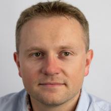
 Piotr Zaborowski
Open Geospatial Consortium
Piotr Zaborowski (male), Project Manager leading and managing OGC Innovation Program initiatives in the agriculture, EO, aviation. He holds an MSc in computer science from Warsaw University of Technology and an EMBA from WUTBS/CEU. Before joining OGC, Piotr was working in the commercial software development sector for Earth observations (like GEOSS Portal as PM/architect, International Charter Space and Major Disasters as BDM/Interim Manager, InCoNaDa as BDM, Disaster Charter Space and Major Disasters Operational System as BDM/PO), telecommunication (team lead/architect/PM) and financial markets(architect). He is fluent in the secure, distributed systems for mass market and large scale computations, but was also supporting RPA products development (CTO) and capacity building initiatives for EO operationalisation and organic growth for the European software sector.

Agriculture and Agri-Food Canada
 B.Berk ÜSTÜNDAĞ
Istanbul Technical University, Turkey
more to be confirmed…
